Welcome to KuSeRa, the online antique trade Germany,
We hope you enjoy looking at our Antique Market - Flea Market - Junk Market - collectors market page.
Here everyone can find something.
From antiques, junk, utensils, porcelain, glass, analogue camera, Design, Art to collectibles.
Everything from a single source.
")
")

![]()
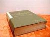
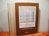
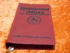
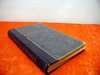
Main page Books Atlases & Maps Relief map of Bavarian Highlands 3 cards circa 1930
Relief map of Bavarian Highlands 3 cards circa 1930
Product no.: xpara-000233sold
Notify on availability
20.00 €
Price includes VAT, plus delivery

Accessories
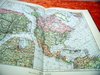
 AEG Germany map boundaries States in 1937 88x88 cm
 Berlin mit Sehenswürdigkeiten Schaffmann Plan
 old map Archiepiscopatvs Maghdebvrgensis
 Map 1850 Cabool, the Punjab and Beloochistan J.B.Allen
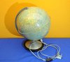
 Columbus Duplex illuminated globe
 Guide to Mannheim Pharus plan of Hapag 1910
 Guide to Wien Pharus plan of Hapag 1910
 Guide to Leipzig Pharus plan of Hapag 1910
 Guide to London Pharus plan of Hapag 1910
 Guide to Berlin Pharus plan of Hapag 1910
 Map Brockhaus 1906 North America I-II
 Map Brockhaus 1906 Switzerland I-II
 Map Brockhaus 1906 South America I-II
 Map Brockhaus 1906 United States of America I-II
 Berlin puzzle maps match game 1962
 Maps measuring device made of metal with case 1950
 Map German Afrika-Linien Woermann 1: 12000000
 Gaeblers World traffic map 1941 color printing 120x80
 Medion MD 41600 Pocket PC / navigation with accessories
 Small Columbus globe of 60s
 Copper engraving hand colored church Wang around 1920
 2 old pewter reliefs puttis at hunting + playful at lake
We also recommend
 |
 |
 |
 |
 |
 |
 |
 |
 |
 |
 |
 |
 |
 |
 |
 |
 |
 |
 |
 |
 |
 |
 |
 |
 |
 |
 |
 |
 |
 |
 |
 |
 |
 |
 |
 |
 |
 |
 |
 |
 |
 |
 |
 |
 |
 |
 |
 |
 |
 |
 |
 |
 |
 |
*
Prices include VAT, plus delivery
Browse these categories as well: Atlases & Maps, Design 1910s-1950s Bauhaus / Art Deco
About us |
Service |
Social Media |
Interesting Websites |
| Contact information | Special Offers | google+ |
|
| Main Page | |||
| Terms and conditions | Sales Agent questions | ||
| Privacy Statement | General questions | Travel bear | |
| About us | Shipping Info | blog | Brand Lexicon |
| History and stories | Price proposal | The ecological approach | Worth knowing from A to Z |
| Sitemap | Interesting websites | ||
| Image Gallery - Sold | Tips for Berlin tourists | Purveyor to the court Gebr.Friedlander | |
| Homepage | Promotional products | Guest book | Technology of binoculars |
| Selling Stories | FAQ Frequently Asked Questions | Decoration-proposals-examples | |
| Biographies designer/artist | |||
| Tips silver cleaning |